FARGO (KFGO) — June 20, 2025. At 11:02 p.m. the Enderlin EF5 tornado touched down. Three people were killed by the twister, two of them in their beds. But the tornado was just one catastrophic piece in a larger destructive weather system that wreaked havoc across the upper U.S. and southern Canada before finally moving out over the Atlantic Ocean June 22.

Radar animation from Grand Forks, ND, on June 20-21, 2025, showing tornadic supercells being overtaken by fast-moving line of storms before entering Minnesota where the combined complex produced extensive damage. Radar loop courtesy of College of DuPage; data from NOAA/National Weather Service
The derecho event spawned 40 tornadoes, with the first spawning near Coalfield, Saskatchewan the evening of June 19. The last produced by the storm were a pair that touched down near Oneida, New York the morning of June 22. Three people were killed by those, officially rated as EF1s.
The violent weather that moved across the region included an EF3 and an EF5 tornado. Weather that strong is extremely rare.
“About a thousand tornadoes occur every year in the United States,” National Weather Service Meteorologist Jim Kaiser says. “Of the thousand, one to two percent are considered violent, so EF4 or EF5. The Enderlin EF5 tornado was the first one rated EF5 in 12 years.”
Kaiser says the last F5 tornado recorded in North Dakota was the infamous June 20, 1957 Fargo tornado that killed 12 people and left 103 people injured. He adds that late June is typically when our region sees violent storms.
“It’s one of our main times of the year where we can kind of point and say, oh, look at this, like we have summer weather clashing with winter weather, and that provides us with fuel for the thunderstorms,” Kaiser says.
Last June, conditions were perfect to create strong storms across the upper Midwest. A strong upper-level jet stream brought cold air that clashed with hot, humid air closer to the surface.
“There were a couple unique situations where we had a warm front draped along I94,” Kaiser says. “That allowed storms that kind of developed south of there ahead of that energy from that upper level jet that was coming out of the west, if anything was to develop along that warm front, we knew that they would be tornadic, or it could be a very tornadic storm. We knew that we were going to have supercellular storms.”
Kaiser says a total of 26 tornadoes were confirmed in North Dakota. That tied the single-day state record for most tornadoes in a day. More twisters were confirmed before and after the system moved through our region, bringing the total number produced by the system to 40.
As the derecho line moved across North Dakota from west to east, it eventually joined with the supercell

A combine sits in a machine shed that was destroyed by high winds in Traill County, N.D. overnight June 20-21, 2025. (Nate Coen/KFGO)
storms that formed in southwest North Dakota. Those storms continued east, and straight-line winds from that line knocked down grain elevators in the Red River Valley, and knocked down thousands of trees in Beltrami and Hubbard Counties in Minnesota.
“They had that blowdown that occurred several hours after the supercell tornadoes occurred here in the valley,” Kaiser says. “It was essentially … almost the tip of an arrow [of energy into] northern Hubbard, southwestern Beltrami County right into Bemidji.”
After the storms moved on, meteorologists at the Grand Forks bureau of the National Weather Service shifted their focus from tracking storms and issuing warnings to investigating damage. Kaiser says his team visited the area hit hardest the morning after the storms, and immediately knew what they were looking at was special.
“It was very obvious, driving around it wasn’t what we typically see when we do our assessments.”
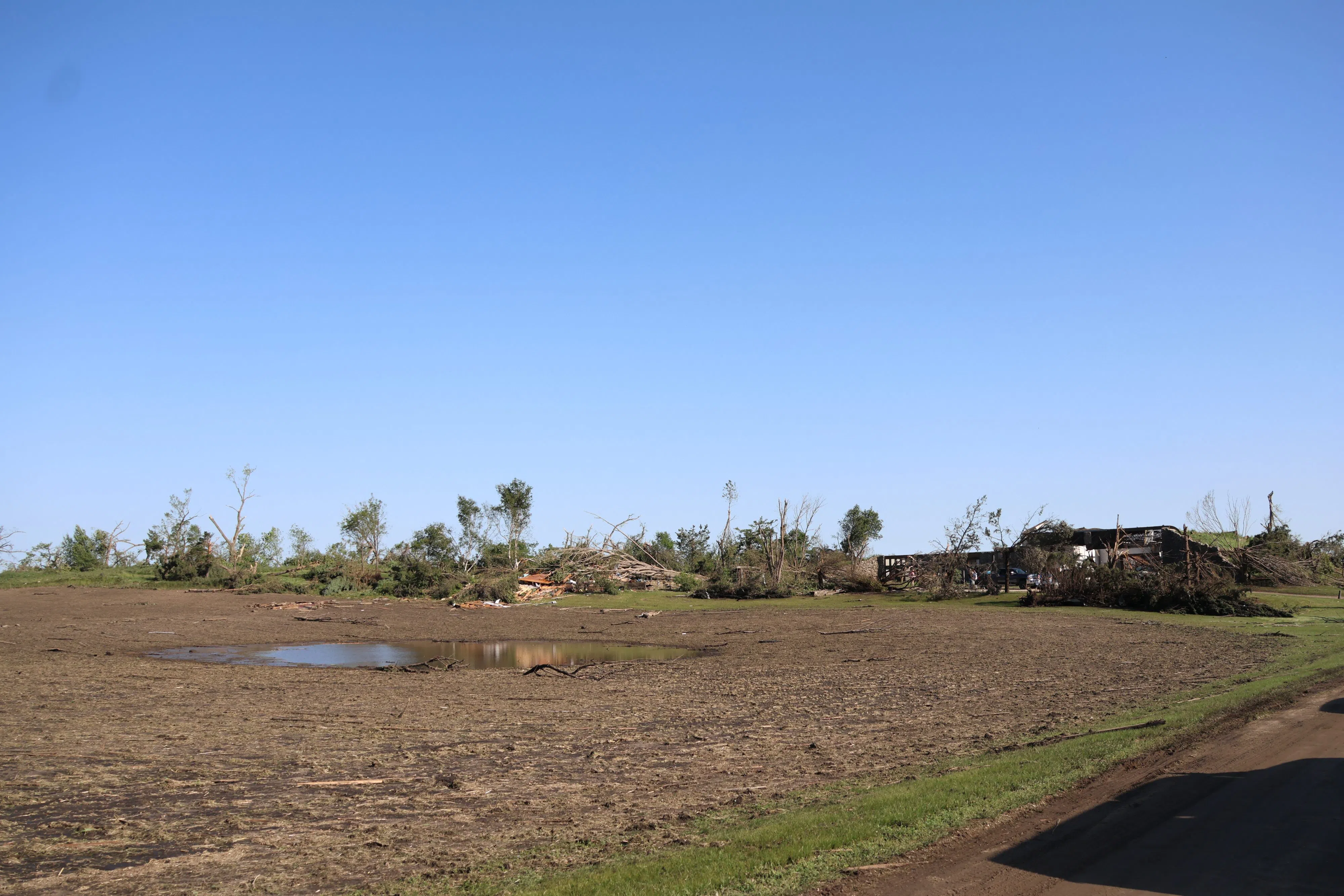
Kaiser says the damage assessment was complicated because the largest tornado moved through an extremely rural area and did not hit many structures or trees. But the tornado did hit a fully loaded grain train, and lifted several cars over 100 meters into a farm field. Kaiser says using trains as damage indicators is not common.
“We don’t have train cars on in our catalog of indicators. We have several other things [catalogued] that could be lofted by wind,” Kaiser says. “Then you still have to consider it’s connected to other train cars, like it had to lift it, pull it, separate it, and then it can toss it a 145 m. So that was our big red flag that we want more experts looking at this piece.”

Shelterbelt damaged by an EF5 tornado east of Enderlin, N.D. overnight June 20-21, 2025 (Joe Leier/KFGO)
The tornado was officially rated an EF5 in October. At its largest, it measured 1.05 miles wide. It was on the ground just over 12 miles. The wind speeds reached an estimated 210 mph, according to the National Weather Service.
A year later, Kaiser says the storm leaves a lasting memory, and will be a talking point for years to come.
“This is an event everybody’s going to talk about 30 years from now. This is an event that’s going on the record books that people are going to talk about to my grandkids.”
A total of five people were killed in the event, three by the Enderlin tornado. Kaiser says while the deaths are tragic, they are a reminder that everyone should have a plan for when severe weather hits.
“The Enderlin tornado came at night. Three fatalities, two of them, the people were still in bed. Either they didn’t hear their radio if they had their weather radio or they didn’t have a plan,” Kaiser says. “We want people to have plans for severe weather, how do you get notification for a warning at any time of the day. Have a plan so that you know where you need to go to be safe for when we get weather because where we live, we know we get weather.”


Comments